“Wild in Westborough” Photo Contest and Exhibit in October
It’s time for photographers of all ages to take a few more pictures and get ready to enter “Wild in Westborough,” WCLT’s photo contest!
[MORE]
|
Two New Trails Open This Fall
This fall Westborough has two new trails, one at the Westboro Wildlife Management Area and the other at WCLT’s Indian Pond property.
[MORE]
|
Meet WCLT’s New Directors
WCLT members elected three new directors at the 2011 Annual Meeting in June.
[MORE]
|
Peter Alden’s Talk Full of Surprises
Many people were surprised by what they heard at the talk, “Changes in Flora & Fauna from Thoreau’s Time to Today,” by naturalist,
lecturer, and ecotourism guide Peter Alden at WCLT's annual meeting in June.
[MORE]
|
Walk the Trails with a Map
What better time than fall to discover the woods, fields, and waters of Westborough?
[MORE]
|
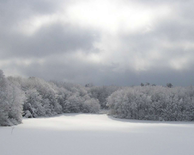
After the Storm, by Robin Fleming (2007 1st Prize Winner)
With the arrival of October, it’s time for photographers of all ages to take a few more pictures and get ready to enter “Wild in
Westborough,” WCLT’s photo contest featuring plants, animals, landscapes, and whatever else is wild or natural in town.
If you’re planning to enter, mark Thursday through Saturday, October 13–15, on your calendar. These are the dates for photo entries to be
dropped off at Tatnuck Bookseller. Drop-off times are Thursday and Friday evenings, 6–8 p.m., and Saturday morning, 10 a.m.–12 noon.
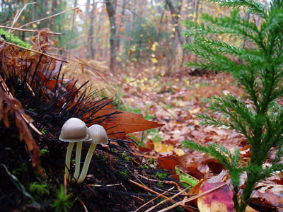
Wile Forest, by Barry Hall (2007 2nd Prize Winner)
Each photographer may enter up to two photos, which must be matted and protected with a glassine envelope.
Get an entry form and contest rules from the WCLT website.
“Although new homes, shops and businesses have sprung up across the local landscape, many natural places still exist in Westborough that inspire
the imagination,” says contest chairman Sharon Williams. “From a tiny tree frog to a sunset lake vista, creative photographs present the
beautiful, untamed face of Westborough. We hope many photographers in the area will share their talents and appreciation of nature with the public
through our exhibit.”
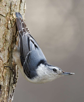
White-Breasted Nuthatch, by Paul J. Weisbach
(2007 3rd Prize and People's Choice Winner)
Whether or not you’re a photographer, plan to come and see the juried selection of the photographs that will be displayed in the “Wild in
Westborough” exhibit, running from Saturday, October 22 to November 6, 2011 at Tatnuck Bookseller (on Route 9 and on Lyman Street near Route 9).
Awards will be given for Best of Show (1st, 2nd, and 3rd) and a Popular Vote Award chosen by exhibit visitors.
A good time to see the exhibit will be the open house on Sunday, October 23 from 2–5 pm at Tatnuck Bookseller. Everyone is welcome at this event
to celebrate contest participants and winners and the natural environment that WCLT has been working to protect.
“Wild in Westborough” is WCLT’s second photo contest. The photos displayed in this article were the winning entries from the first
photo contest, held in 2007.
Back to top
|
|
This fall Westborough has two new trails, one at the Westboro Wildlife Management Area (known locally as “Fish and Wildlife”) and the other
at WCLT’s Indian Pond property, both thanks to the hard work of the town’s Boy Scouts.
New Fish & Wildlife Trail Attracts Large Crowd
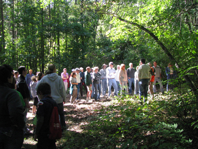
Photo by Kathy Leblanc
September 18 walk at the Westboro Wildlife Management Area
WCLT introduced 75 people to the new trail at the Westboro Management Area at a September 18 walk, “Hiking through History,” led by WCLT
stewards Marge Fisher and Don Burn. The new trail, about six-tenths (0.6) of a mile long, is part of a longer 2.5-mile loop route that the group followed as
the walk leaders discussed the history of the area.
That history includes the first settlement in Westborough, which was on the shores of Lake Chauncy in the late 1600s, and the transformation of the area
through the years of the Lyman reform school for boys and the Westborough State Hospital in the 19th century. The trail follows parts of an old stone wall
from the property’s farm days through what today are beautiful, deep woods. The whole area represents a bit of history-become-wilderness right here
in town.
“You wouldn’t believe it’s Westborough,” one walker commented about the secluded woodlands.
Eagle Scout candidate Alex Barnhart of Troop 100 created the new trail during the summer as his Eagle project. He organized and worked with crews of
Boy Scouts in several work sessions, involving a total of about 30 individuals, to clear and extend an old, overgrown woods road dating from the days of
the old Lyman School.
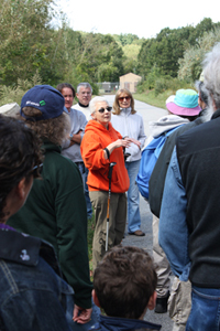 Photo by Brian Barnhart
Marge Fisher talks to the crowd at
the September 18 walk
Walk leader Marge Fisher, who monitors trails in the north end of town for WCLT, noted that Alex made wise choices in planning the exact route of the
trail. She said that Alex and his Scout crews put a tremendous amount of work into making a path that is comfortable and easy to walk.
“You could walk it in bedroom slippers,” Marge commented. She noted that the trail will quickly become well hardened with use. That process
got off to a good start with the 75 pairs of feet that traipsed along the trail on September’s inaugural walk.
Later this year, two new maps of the Westboro Management Area will be available on the WCLT website. Check the website in November or December to print
and download these new maps and see the many trails and various loops you can walk in the area, including loops containing the new trail.
New Trail Makes WCLT’s Indian Pond Accessible
Westborough’s second new trail opens up WCLT’s Indian Pond property to walkers. This trail will be introduced to the public on a WCLT walk
on Sunday, October 9 at 1:30 p.m. Everyone is invited to come out and enjoy the foliage and look for wildlife! Parking is available at the end of Meadow
Road, which is located off Route 135 (Milk Street) just before West Meadow Plaza.
Marge Fisher will lead the walk along the new ¾-mile trail, beginning at Meadow Road and following the shoreline of Indian Pond and then proceeding
uphill to a knoll overlooking the Assabet River. The group will then return to the parking area along the same trail, for a walk totaling 1½ miles.
Indian Pond is a 2-acre former farm pond (slightly smaller than Gilmore Pond). The new trail makes it accessible, thanks to the labors of WCLT stewards and
Scouts. Much of the land surrounding the pond is red maple swamp and wetland containing native wetland plants such as spicebush, skunk cabbage, and false
hellebore.
A National Trails Day work party led by Marge Fisher in June completed the new trail. The group included six WCLT stewards and four Scouts. Among other work,
they constructed three bog bridges to help walkers keep their feet dry.
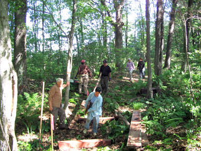
Photo by Don Burn
Building a bog bridge at Indian Pond
Eagle Scout candidates working on the Indian Pond property focused their projects on removing invasive shrubs, especially burning bush and non-native
honeysuckle. Those involved in this extensive invasive removal work included Ben Roth in 2009 and Dan Buress in 2010, as well Dan Murphy and Brian Coutinho
in 2011.
WCLT acquired the Indian Pond property in 2009 through a donation from the Indian Pond Trust, a local homeowners association of families on Indian Pond Road.
The property connects to other WCLT properties and allows the completion of what will eventually be an important link in the Charm Bracelet trail system
encircling Westborough.
Many thanks to all the volunteers—Eagle Scout candidates and their Scout crews, WCLT stewards, and other people from the community—who labored
long and hard to create these two new trails for residents of Westborough and beyond.
Back to top
|
|
Westborough Community Land Trust members elected three new directors at the 2011 Annual Meeting in June. The membership also approved officers for
2011-2012.
Mary Casey
As vice president for college advancement at Wheaton College in Norton, Mary has extensive fund-raising experience, including personal solicitation,
devising campaign strategy, and identifying future donors. In addition to her professional work, she has shared her expertise as a volunteer for St.
Luke’s Church in Westborough, The Perkins School for the Blind, and Mount Holyoke College. She and her husband, Mark Caplan, have been residents of
Westborough for fourteen years.
Marjorie Fisher
Marge has been an active member of the WCLT Stewardship Committee. She is an avid hiker who regularly monitors trails on the north side of town at Fish
and Wildlife, Cedar Hill, and Sawink Farm, as well as WCLT’s Indian Pond. Her background is in teaching and health information management. She has
served many terms as president and secretary of her condo association.
Kelly Thomas
Kelly was an original member of the WCLT board from 1997–1999. He is a certified public accountant and founder of Thomas Financial Associates. Kelly
has been active in several non-profit organizations and on boards of directors including the Unitarian Universalist Church, Lions Club, United Way, and YMCA.
Officers
Officers re-elected for 2011–2012 include: John Metzger, president; Allison Johnson Hall, treasurer; and Steven Rowell, assistant treasurer.
Newly elected officers for 2011–2012 are: Sharon Williams, vice president; Marjorie Fisher, secretary; and members-at-large Sue Abladian and
Scott Shumway.
Back to top
|
|
Many people were surprised by what they heard at the talk, “Changes in Flora & Fauna from Thoreau’s Time to Today,” by naturalist,
lecturer, and ecotourism guide Peter Alden at the Westborough Community Land Trust’s annual meeting in June.
- Anyone who had imagined Thoreau’s time as one of deep woods and wild animals roaming the New England landscape discovered that this idea is wrong.
- Those who had a sneaking suspicion that there were many fewer invasive plants around when they were growing up were surprised to discover that they are
right!
- People who worry about climate change were surprised by Alden’s claim that southern birds are moving northward into New England, not because of global
warming, but due to bird-feeding and the fruiting of invasive plants.
- Anyone who likes to catch sight of deer discovered that deer are New England’s number one environmental problem, according to Alden.
- People who gather oriental bittersweet vines for colorful fall decorations were unsettled by Alden’s claim that this vine is a menace that will be
the death of all the trees in New England.
- People who regularly fill their bird feeders learned that, on balance, Alden does not view bird-feeding as a good thing.
In a nutshell: Alden pointed out that the New England landscape has changed greatly over the years as land uses have changed, so that today there are more
woods and many fewer fields and pastures than in Thoreau’s day when farming prevailed. Today our natural environment is filling with invasive plants,
which themselves are bringing changes. Many of the birds we see today are different than in Thoreau’s time, attracted to our area by bird feeding and
the fruiting of invasive plants. Because forests have returned, we now also glimpse mammals such as beaver, deer, and coyotes that were rarely seen around
here in Thoreau’s time. Today we have exploding populations of white-tailed deer and mid-sized carnivores such as coyotes. Due to the large numbers of
deer and invasive plants (which deer don’t usually eat), our wildflowers are fast disappearing, and with them, our butterflies.
For particulars, read on.
Thoreau’s time and place were more than 160 years ago in nearby Concord, Mass. There, Henry David Thoreau (1817–1862) wrote Walden (1854),
the book we associate with his name today, and many other writings. He was, according to Alden, a good botanist and ornithologist for his day, who made notes
of blooming times and bird-returning times over 12 years.
Compared to Thoreau’s time in the 1850s, today wildflowers in our area bloom one week earlier, and birds that winter in the southeastern U.S. return
a week earlier. In contrast, birds that winter in the Amazon area come back about the same time.
What does this mean? In the 1800s, Alden said, 90 percent of the forests in New England south of the White Mountains were gone—converted into fields
and pastures for agriculture, but forests in Latin America were fine. Today, the situation has reversed. Woods have returned to New England, but forests in
Central and South America are being cleared on a large scale.
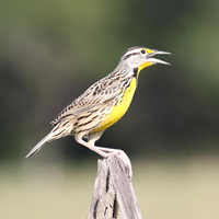 Photo by Alastair Rae
Eastern Meadowlark
In Thoreau’s time, our area had grassland birds that had come east from the Great Plains. These birds are now retreating. The meadowlark, for example,
is the bird that’s disappearing fastest from Massachusetts. It’s still found in 30 Massachusetts towns, often in the grassy open areas around
airports (such as the Worcester airport). The largest increase in meadowlarks today is in Latin America, where land is rapidly being cleared.
Cowbirds, which once followed American bison on the plains and are known for laying their eggs in the nests of other birds, also came east when forests were
cleared here, but they have stayed. Today cows and birdfeeders in the east help to sustain them. On a walk earlier in the day at the Town of Westborough’s
Veterans Freedom Park (formerly the Lee property), Alden had spotted chipping sparrow parents feeding two large cowbird chicks. He reported that for wood
thrush nests to be free of cowbird eggs, they have to be located deep in the woods, at least one mile away from the woodland edges.
The Audubon bird counts show that some birds are moving their ranges north, but this is not because of climate change. It’s because of bird feeding
and invasive plants.
We’ll find nothing in Thoreau’s writings about invasive plants, Alden said. Most of the invasive plants in the northeastern U.S. today came from
the Far East—northern Japan, Korea, the Russian far east, and China north of Beijing, especially around the Amur River.
How did invasive plants get here? “The botany community brought them here to sell,” Alden said.
Oriental bittersweet is an invasive climbing vine that Alden sees as especially destructive to our area. “It’s going to kill all the
trees!” Alden warned.
Other invasive plants in our area that were largely absent in Thoreau’s time include Japanese knotweed, Norway maple (from Europe), tree of heaven
(Ailanthus altissima) with its “leaves that smell like cat urine,” and black locust (native to the southeastern U.S, not New England) which is
replacing oak forests in southeastern Massachusetts.
Unfortunately, Alden noted, almost no native insects in our area eat the leaves of invasives. For this reason, as invasives replace native plants, he
predicted “there will be no insects in June for birds to feed to their babies.” This means that the Baltimore oriole, which comes here to breed
after wintering in Latin America, and the scarlet tanager, which flies here from South America, won’t find insects for their young. There will be no bugs
for local pileated woodpeckers to eat, he said, unless it turns out that they eat the invasive Asian longhorned beetle.
Why haven’t popular non-native plants such as lilacs and forsythia become invasive? Unlike invasives, they do not bear fruit that allows birds, wind,
and rain to spread them considerable distances, helping them to leap-frog into new locations. They stay in the area where they were planted.
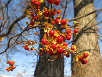 Oriental bittersweet
Alden said New England today is a “Fruitopia” for birds in August and September, due especially to invasives that produce fruit: Morrow’s
and oriental honeysuckles, burning bush, autumn olive, and oriental bittersweet vine. These plants, like so many invasives, compete well with native plants
partly because they leaf out earlier in the spring, and keep their leaves much longer in the fall.
Other, newer invasives are arriving in Massachusetts: porcelain-berry, black swallowwort, mile-a-minute vine, Japanese stilt grass (recognizable by a
white line down the leaf, now arriving in the nearby Blackstone valley), garlic mustard, and yes, even kudzu from the South.
Non-native Phragmites (common reed) is drying up wetlands, hurting the native wood ducks that use them. Water chestnut is invading our lakes, ponds,
and waterways. It is spread mainly by Canada geese, which themselves are an invasive non-native species, Alden said.
Part of the remedy for the spread of invasive plants, Alden suggested, is to change the laws that regulate herbicides, give more protection to uplands, and
appoint an invasive alien “czar” to coordinate and oversee efforts to control invasive plants.
Surprisingly, today we see many mammals that weren’t common in Thoreau’s time, Alden said.
Beavers weren’t much seen around here in Thoreau’s time, or even in the 1950s. Back then, kids would shoot them. Today beavers are protected
and doing well, spreading as woodlands spread. Thanks partly to beaver-created wetlands and man-made ponds, we now also have more great blue herons. They
weren’t seen in Thoreau’s time, but now Concord has 68 pairs.
Black bears sometimes appear today in eastern Massachusetts, thanks to bird feeders that are available for them to raid—not so in Thoreau’s
time.
Coyotes are more common now than in Thoreau’s time, as are fishers (a medium-sized weasel that eats porcupines, small mammals, and the occasional
housecat). These animals are part of an explosion of medium-sized carnivore populations, due to laws that allow very little trapping in Massachusetts.
Moose are now seen in Massachusetts, mainly west of Worcester.
Deer are so common today that they are the number one problem in New England, Alden claimed. The overpopulation of white-tailed deer is eating our native
wildflowers, helping to wipe them out, along with the butterflies that depend on them. Alden reports that approximately 25 percent of the wildflowers in Concord
from Thoreau’s time have died off since the 1970s, when wildflowers in the area were pretty much the same ones as in Thoreau’s time.
If you see a wooded area with lots of ferns, Alden said, you know you have deer, because deer don’t eat ferns. In contrast, he said, if you visit West
Virginia, which has very few deer, you’ll see lots of wildflowers.
Part of the solution for the deer problem, Alden suggested, would be to bring back mountain lions and wolves, the natural predators of deer.
What birds are new in our area since Thoreau’s time? Mute swans (which are non-native) and mallard ducks (which are wiping out native black ducks
by interbreeding with them) are relatively new. The pigeons we see in towns and cities are also non-native, as are house sparrows and starlings, both of
which readily take over nesting boxes put out for native bluebirds.
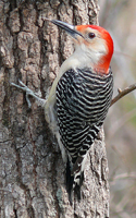 Red-bellied woodpecker
Cardinals, red-bellied woodpeckers, tufted titmice, and Carolina wrens lived farther south in Thoreau’s time but are in our area today because of
bird-feeding.
Today Cooper’s hawks and sharp-shinned hawks kill birds at bird feeders, and red-tailed hawks eat squirrels that fatten on sunflower seeds at bird
feeders. This did not happen in Thoreau’s time because people did not feed birds back then.
Unlike what some people might expect from a naturalist, Alden does not favor bird-feeding. It’s not natural!
Wild turkeys had disappeared from Massachusetts but have made a comeback in recent years, now that we have woods again. They roost in trees at night, where
they are safe from coyotes, which are getting other large native ground birds such as ruffed grouse.
Today we can again see birds whose populations had declined sharply decades ago due to the effects of DDT. They include bald eagles, double-crested
cormorants, and osprey. Although DDT is now banned in this country, Alden warns, the U.S. still sells it overseas, where it harms birds that migrate to other
countries.
Whether they agreed with everything or not, members found Peter Alden’s talk entertaining, provocative, and full of information as well as surprises.
Back to top
|
|
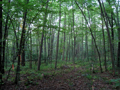
Photo by Vivian Kimball
What better time than fall to discover the woods, fields, and waters of Westborough? Many of us know less than we’d like about the trails and open
space areas in town. Now you can make use of a growing series of trail maps by WCLT and two by Sudbury Valley Trustees to find out more and to take yourself
on explorations of the wonderful open space areas in town, the Charm Bracelet trail, and many side trails.
Each map comes in a pamphlet that also contains an introductory description of the mapped area, driving directions, and a description of a recommended walk.
Visit the WCLT web site to download and print out the map pamphlet you wish to carry with you.
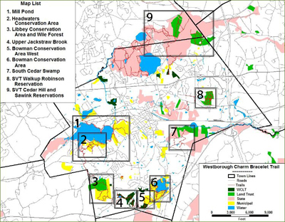
At present, you can choose from nine open space areas to explore with the help of these maps. Below, we have reproduced the introductory descriptions of
these nine areas. Click on the following links to see the maps and to download and print them.
- Mill Pond Area (the larger area around Mill Pond, including Headwaters Conservation Area and Veterans Freedom Park)
- Headwaters Conservation Area (the Town’s second conservation area)
- Libbey Conservation Area & Wile Forest (Libbey is the Town’s third conservation area)
- Upper Jackstraw Brook Reservation (WCLT’s largest parcel of land)
- Bowman West and WCLT Hidden Meadow (Town and WCLT areas)
- Bowman Conservation Area (the Town’s first conservation area)
- Cedar Swamp (land owned by St. Luke’s Catholic Church, the state, and Sudbury Valley Trustees)
- Walkup and Robinson Memorial Reservation (a Sudbury Valley Trustees reservation)
- Crane Swamp Regional Trails (including Sudbury Valley Trustees’ Sawink Farm and Cedar Hill)
As noted, these open space areas are owned by various entities, including the Town of Westborough, WCLT, other land trusts such as Sudbury Valley Trustees
(SVT) and New England Forestry Foundation (NEFF), St. Luke’s Catholic Church, and the State of Massachusetts.
MILL POND AREA
 The Mill Pond Area is an extensive region containing the pond and
undeveloped land to enjoy. Its core is the SuAsCo A1 reservoir and surrounding land that the state acquired for flood control in the late 1960s. In addition to 380
acres owned by the state are 250 acres of Town land, including the Country Club, the Pazo Property next to Gibbons School, the Headwaters Conservation Area, and
Veterans Freedom Park. The Mill Pond Area is an extensive region containing the pond and
undeveloped land to enjoy. Its core is the SuAsCo A1 reservoir and surrounding land that the state acquired for flood control in the late 1960s. In addition to 380
acres owned by the state are 250 acres of Town land, including the Country Club, the Pazo Property next to Gibbons School, the Headwaters Conservation Area, and
Veterans Freedom Park.
The Mill Pond area is suitable for hiking, cross-country skiing, and related passive recreation. The trails are easy to hike with mild grades and during summer months
feature a rich variety of woodland and shoreline wildflowers.
http://www.westboroughcharm.org/guide/maps/mill_pond_map.pdf
HEADWATERS CONSERVATION AREA
 The Headwaters Conservation Area (HCA) protects the headwaters of the
Assabet River. The walking trails include expansive hilltop overviews of Mill Pond, glacial rock formations and unique wildlife habitat. The area is the
nesting location for osprey and several families of white swan. Beaver, fox, deer and small mammals are also found here. HCA is also an important stop for
warblers and other migratory birds. The Headwaters Conservation Area (HCA) protects the headwaters of the
Assabet River. The walking trails include expansive hilltop overviews of Mill Pond, glacial rock formations and unique wildlife habitat. The area is the
nesting location for osprey and several families of white swan. Beaver, fox, deer and small mammals are also found here. HCA is also an important stop for
warblers and other migratory birds.
HCA contains 100 acres of open space, most of which was purchased by the Town in 1998. It protects 35 percent of the Town’s water supply, important
wildlife habitats, and open space for passive recreation. The Westborough Historical Commission has identified some archeological sites on the area, containing
prehistoric artifacts dating back 8,000 years.
The area is suitable for hiking, cross-country skiing and related passive recreation, and the trails are easy to hike with mild grades. During summer months,
the area features a rich variety of woodland and shoreline wildflowers.
http://www.westboroughcharm.org/guide/maps/hca_trail_map.pdf
LIBBEY CONSERVATION AREA & WILE FOREST
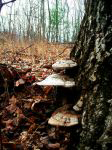 The Wile Forest is owned by the New England Forestry Foundation (NEFF). This 87-acre woodlot was donated in 1986 by William H. Palmer Wile. The Libbey
Conservation Area (LCA) was a gift to the Town in 1995 by William C. Libbey and Mary Ellen Libbey. This 110-acre parcel is adjacent to the Wile Forest. In
2003, WCLT acquired an additional 2.5 acres adjacent to the LCA. The Wile Forest is owned by the New England Forestry Foundation (NEFF). This 87-acre woodlot was donated in 1986 by William H. Palmer Wile. The Libbey
Conservation Area (LCA) was a gift to the Town in 1995 by William C. Libbey and Mary Ellen Libbey. This 110-acre parcel is adjacent to the Wile Forest. In
2003, WCLT acquired an additional 2.5 acres adjacent to the LCA.
The trails take walkers deep into undeveloped woods. The trail passes through many wet areas, so choose footwear accordingly, especially in spring and
early summer. These wet areas are marked by lush fern growth and wetland plants such as spicebush with its small early-spring blossoms
and aromatic bark and leaves. The trail also crosses lovely wooded uplands and follows scenic stone walls left over from earlier days when these woods were
farmland.
http://www.westboroughcharm.org/guide/maps/libbeywile_trail_map.pdf
UPPER JACKSTRAW BROOK RESERVATION
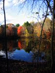 At 53 acres Upper Jackstraw Brook Reservation is the Westborough
Community Land Trust’s largest parcel. It is located on open land obtained from the creation of the Orchard Hill, The Orchard and Pheasant Hill subdivisions. At 53 acres Upper Jackstraw Brook Reservation is the Westborough
Community Land Trust’s largest parcel. It is located on open land obtained from the creation of the Orchard Hill, The Orchard and Pheasant Hill subdivisions.
The trails take walkers along the upper reaches of Jackstraw Brook through a mixed hardwood forest. The trail leads to Gilmore Pond, the headwaters of
Jackstraw Brook.
In 2007 the Westborough Community Land Trust, with assistance from the Westborough Civic Club, started an effort to make a woodland park in the 12-acre
area around Gilmore Pond. This effort includes removing invasive plants and improving the trails around the pond. See the sidebar item for
information about how you can help.
http://www.westboroughcharm.org/guide/maps/upperjackstraw_trail_map.pdf
BOWMAN WEST & WCLT HIDDEN MEADOW
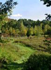 The western part of the Bowman Conservation Area and the WCLT Hidden Meadow property were for years an unexplored gem in Westborough. This 59-acre area had
no trails or access to it until the Charm Bracelet Trail opened the area in 2000. The trails take walkers into a mixed hardwood forest with views into a
wetland in the center of the property. The western part of the Bowman Conservation Area and the WCLT Hidden Meadow property were for years an unexplored gem in Westborough. This 59-acre area had
no trails or access to it until the Charm Bracelet Trail opened the area in 2000. The trails take walkers into a mixed hardwood forest with views into a
wetland in the center of the property.
In 2005 the Westborough Community Land Trust started an effort to reclaim the 2-acre meadow on our property. With the help of many volunteers, the brush was
cleared from this area to restore an open field providing varied habitat.
http://www.westboroughcharm.org/guide/maps/bowmanwest_trail_map.pdf
BOWMAN CONSERVATION AREA
 The Bowman Conservation Area was purchased by the Town in the late 1960s
to protect Sandra Pond, then the town’s water supply. The woods of the conservation area are a mixture of hardwoods and red pines planted after the
1953 tornado devastated the area. Most walkers know of the limited trails displayed on the sign at the entrance to the area, but a much wider range of trails
are available, including routes that circle the pond. The Bowman Conservation Area was purchased by the Town in the late 1960s
to protect Sandra Pond, then the town’s water supply. The woods of the conservation area are a mixture of hardwoods and red pines planted after the
1953 tornado devastated the area. Most walkers know of the limited trails displayed on the sign at the entrance to the area, but a much wider range of trails
are available, including routes that circle the pond.
http://www.westboroughcharm.org/guide/maps/bowman_map.pdf
CEDAR SWAMP
 Cedar Swamp was the state’s first Area of Critical Environmental Concern (ACEC). Much of the land in the swamp is protected by ownership by either
the Department of Conservation and Recreation or the Sudbury Valley Trustees. St. Luke’s Cemetery and the adjoining back land is the largest unprotected
open space parcel in the swamp. Cedar Swamp was the state’s first Area of Critical Environmental Concern (ACEC). Much of the land in the swamp is protected by ownership by either
the Department of Conservation and Recreation or the Sudbury Valley Trustees. St. Luke’s Cemetery and the adjoining back land is the largest unprotected
open space parcel in the swamp.
Adjacent to the cemetery is Heirloom Harvest Community Farm, a certified organic community supported agriculture (CSA) farm. The farm includes 17 acres
total, with 8 acres in production in any season. The farm is surrounded on three sides by fields that are managed for the benefit of nesting field birds such
as bobolinks and meadowlarks. Wildlife is abundant.
http://www.westboroughcharm.org/guide/maps/south_cedar_swamp_trail_map.pdf
WALKUP & ROBINSON MEMORIAL RESERVATION
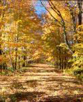 The 62-acre Walkup and Robinson Memorial Reservation on Flanders Road was left to Sudbury Valley Trustees in 1980 by Lawrence Walkup, a farmer and lifelong
resident of the town. The reservation is a memorial to his parents and to the four generations of his family that farmed this land. Mr. Walkup wanted the land
to remain open as a sanctuary for wildlife and for compatible quiet recreation. The 62-acre Walkup and Robinson Memorial Reservation on Flanders Road was left to Sudbury Valley Trustees in 1980 by Lawrence Walkup, a farmer and lifelong
resident of the town. The reservation is a memorial to his parents and to the four generations of his family that farmed this land. Mr. Walkup wanted the land
to remain open as a sanctuary for wildlife and for compatible quiet recreation.
The property includes mixed hardwood and old pasture uplands, wooded wetland, a bit of open field, and a small pond. It is ideal for walking, for jogging,
and for viewing wildlife.
Due to ongoing development in the surrounding industrial district, the reservation is an island of open space, somewhat diminishing its habitat value, but
increasing its importance as a quiet oasis. SVT management seeks to maximize viable habitat for native plants and wildlife and to provide opportunities for
quiet recreation. The remnant of open pasture will be preserved, recalling the small self-sufficient farms that provided food to the local community.
http://www.sudburyvalleytrustees.org/sites/default/files/Walkup.pdf
CRANE SWAMP REGIONAL TRAILS
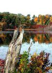 The Crane Swamp Conservation Area includes 2,225 acres of open space straddling the borders of Northborough, Westborough, Southborough, and Marlborough.
The centerpiece is a high quality 400-acre red maple swamp. The swamp is surrounded by a complex of open fields, wet meadows, ponds, pine plantations, and
oak-pine forests, with Cedar Hill to the west and Walnut Hill to the northeast. Such a diverse, high quality and expansive conservation area is a unique
treasure in Metrowest Boston. The Crane Swamp Conservation Area includes 2,225 acres of open space straddling the borders of Northborough, Westborough, Southborough, and Marlborough.
The centerpiece is a high quality 400-acre red maple swamp. The swamp is surrounded by a complex of open fields, wet meadows, ponds, pine plantations, and
oak-pine forests, with Cedar Hill to the west and Walnut Hill to the northeast. Such a diverse, high quality and expansive conservation area is a unique
treasure in Metrowest Boston.
The properties are owned by a variety of Massachusetts state agencies as well as the Sudbury Valley Trustees (SVT). SVT protected 101 acres of Sawink Farm
Reservation at the border of Northborough and Westborough in 1992 and the 88-acre drumlin of Cedar Hill in Northborough in 1993. The Department of Conservation
and Recreation (DCR) owns Crane Swamp, Little Crane Swamp, and much of Walnut Hill, just north of Sawink Farm Reservation. Westborough State Hospital land
extends from Lyman Street to Chauncy Pond, and the Massachusetts Division of Fish & Game owns land which runs west to the Assabet River. Furthermore, the
protected watershed helps to preserve the public water supply for 2.5 million people.
This mosaic of different habitats provides for a rich array of plants and animals, including state-listed species, interior-sensitive forest birds, and
species which need to range some distance throughout the year for survival. Wildlife species known to inhabit the conservation area include bobcat, coyote,
red fox, eastern cottontail rabbit, snowshoe hare, white-tailed deer, barred owl, ruffed grouse, American woodcock, spotted turtle, and the Monarch butterfly.
The four communities of Marlborough, Southborough, Westborough, and Northborough, together with Sudbury Valley Trustees and the Westborough Community Land
Trust worked with the Massachusetts Water Resources Authority (MWRA) to develop an interconnected trail network. Prior to construction of MWRA’s new
water treatment plant at Walnut Hill, SVT maintained a connecting trail around the north end of Crane Swamp. As part of the plant construction, the MWRA
recreated and improved the trail connection around the north side of the swamp. SVT and the WCLT are working on a cooperative agreement with the DCR to
establish additional connector trails across the top of Walnut Hill.
http://www.sudburyvalleytrustees.org/sites/default/files/CraneSwamp.pdf
Back to top
|
|
|