
WCLT 25th Anniversary
Trail Challenge
 We are continuing WCLT’s 25th Anniversary Trail Challenge beyond our 25th Anniversary!
Hike 25 miles of trails around Westborough, and keep track of your total distance.
Email 25miles@westboroughlandtrust.org
when you’ve reached 25 miles so we can give you a special commemorative patch (while supplies last) and add your name to our 25-Milers Hall of Fame.
Please also post selfies or photos from your favorite hikes to the WCLT Facebook page to encourage others to explore our great trail network.
We are continuing WCLT’s 25th Anniversary Trail Challenge beyond our 25th Anniversary!
Hike 25 miles of trails around Westborough, and keep track of your total distance.
Email 25miles@westboroughlandtrust.org
when you’ve reached 25 miles so we can give you a special commemorative patch (while supplies last) and add your name to our 25-Milers Hall of Fame.
Please also post selfies or photos from your favorite hikes to the WCLT Facebook page to encourage others to explore our great trail network.
The following list of suggested hikes is roughly grouped by distance, with shorter hikes of up to 2 miles, medium hikes of about 2-5 miles, and long hikes of 5-7 miles. Some are loops, some are a combination of a loop and out & back (like a lollipop), and some can be done as a one-way hike with a car spot, or out and back. Try a hike in each of the WCLT properties.
Short Hikes (up to 2 miles with not much up and down)
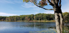
Gilmore Pond trail
Gilmore Pond Loop (0.4 miles total) -
a “must-do” hike! Come and see WCLT’s beautiful All-Person’s Trail, with wheelchair-friendly boardwalks and rope handrail encircling Gilmore Pond. Park on Quick Farm Rd.
Gilmore Pond Loop map (.pdf)Lake Chauncy Ball Field to Boat Launch (1.2 miles one way, 2.4 miles there and back) –
Chauncy Lake Shore map (.pdf)Veterans Park Cross Country Loop (1 mile) –
go around 3 times for a 5K!
Vetrans' Freedom Park Loop map (.pdf)Lake Chauncy to Little Lake Chauncy with loop (1.6 miles) –
see both lakes and farmland in between.
Little Chauncy map (.pdf)Mill Pond School Loop (1.4 miles) –
start and end at Mill Pond School Loop, taking the Platform Trail to Assabet Trail to Osprey Point (do you see any ospreys or swans?) to Volunteer Trail to Oak Ridge Trail back to the school.
Mill Pond School Loop map (.pdf)
Despres Conservation Area
Walkup Robinson Loop (1.1 mile loop) –
follow the red blazes.
Walkup/Robinson Red Trail Loop map (.pdf)Cedar Swamp/St Luke's Cemetery (1 mile loop) –
around farmland/meadow near the cemetery on Hopkinton Rd.
St. Luke's Loop map (.pdf)Despres Property Loop (1.3 mile loop from Eli Whitney Rd) –
Explore land purchased by Westborough in 2021.
Despres Conservation Area map (.pdf)
Medium Hikes (1 - 5 miles total)
Sandra Pond/Bowman Conservation Area Loop (2.4 miles total) –
you can start/end at either Minuteman Park on Upton Rd, or at the Bowman St parking area.
Sandra Pond map (.pdf)Gibbons School Spur (0.7 miles one way, 1.4 miles round trip) –
can be combined with Fox Hill.
Gibbons School Spur map (.pdf)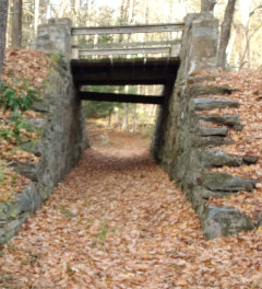
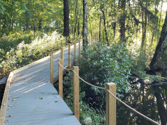
Walkup/Robinson bridge
Sawink Farm - Walnut Hill Loop (1.9 miles total) –
nice hill workout.
Sawink Farm and Walnut Hill map (.pdf)Fox Hill and Veterans Park Combination to make a loop (1.7 miles total) –
by walking along the sidewalk on West Main St.
Fox Hill and Vetrans' Freedom Park map (.pdf)Fox Hill Golf Course to Mill Road (0.7 miles one way, 1.4 miles round trip) –
steep up & down Fox Hill. Hill.
Fox Hill Trail map (.pdf)Libbey - Wile Lollipop from Gilmore Pond (2.9 miles total) –
Easiest parking on Quick Farm Rd and then you get to explore the Gilmore Pond Loop as well.Libbey Trail to Farm Spring Trail then back to Gilmore Pond, around the other side.
Libbey Lollipop map (.pdf)Lake Chauncy with Fish & WIldlife Loop (4.2 miles total) –
trails are unmarked so some route-finding skills are necessary.
MacCallum Wildlife Management Area map (.pdf)
Long Hikes (5+ miles total)
Hocomocco Pond
Mill Pond School around Mill Pond to Hocomocco Pond (3.8 miles one-way, 7.6 miles there & back) –
Did you know you could walk from Mill Pond School all the way to the train station on trails?
Hocomocco to Mill Pond map (.pdf)Carrol St to Minuteman Park via Gilmore Pond and Sandra Pond (5.4 miles one-way) –
the classic 5-mile hike that takes you along some of WCLT’s prettiest trails and charms.
Wile Forest to Minuteman Park map (.pdf)Walnut Hill plus Cedar Hill Loop to Sawink Farm Loop (5.4 miles total) –
has 2 good hills and one of the best views in Westborough from atop Cedar Hill.
Walnut Hill and Cedar Hill map (.pdf)
Westborough Community Land Trust, PO Box 838, Westborough , MA 01581
-- Contact -- Contribute or Join! --